

Survey Department

The Services We Offer :
Establishing Control Point with (Static/RTK & Traversing T.S).
Establishing control points using Static or RTK methods ensures high accuracy, essential for precise surveying tasks. RTK systems enhance efficiency by providing real-time data processing, speeding up project completion. Additionally, traversing Total Stations (T.S.) offer versatility across various terrains, making them perfect for fieldwork. Together, these methods significantly improve the quality and efficiency of surveying projects.
DGPS Survey (Cable Route Survey Ooredoo).
DGPS offers high accuracy for precise cable route placement, ensuring effective infrastructure positioning. With real-time data collection, surveyors can swiftly address issues during the process. The technology streamlines workflows, reducing data collection time and accelerating project completion. Overall, these advantages make DGPS an essential tool for Ooredoo’s cable route planning.
Water Distribution Pipe Line Survey
A comprehensive water distribution pipeline survey is crucial for the efficiency and reliability of water supply systems. It assesses existing pipelines to identify leaks, blockages, and maintenance needs. Using advanced technology, the survey offers insights to optimize water distribution networks, promoting sustainable water management and improving community service delivery.
Contour Mapping
Contour mapping offers detailed visual representations of terrain elevation and landforms, aiding precise planning for construction, landscaping, and environmental management. It is invaluable for engineers, architects, and land developers in understanding site topography, enhancing decision-making, and promoting sustainable land use practices.
Detail Topographical Survey
A topographical survey is crucial for understanding a landscape’s features, offering vital data for construction and land development. It includes precise measurements of terrain, elevation changes, structures, and vegetation. Using advanced technology, professionals create accurate maps and models that guide planning and design. Investing in a topographical survey ensures projects rely on reliable information, leading to successful outcomes.
Digital Terrain Profiling
Digital Terrain Profiling is a high-tech service that creates detailed topographical maps of the Earth’s surface. It is crucial for urban planning, environmental assessment, and construction, providing accurate terrain data that helps professionals make informed decisions and optimize land use. This precision enhances project outcomes and reduces risks.
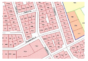
Cadastral Survey
Cadastral survey services are vital for defining property boundaries and maintaining accurate land ownership records. They are essential for legal documentation, real estate transactions, and dispute resolution. Utilizing advanced technology and skilled professionals, these surveys offer reliable data that supports urban planning and development, enhancing property value and promoting sustainable land management.
Traffic Time Survey
Traffic Time Survey provides a detailed analysis of urban traffic patterns and congestion. Using advanced data collection methods, it offers insights that aid city planners and transportation agencies in making informed decisions. This service enhances traffic management, improves road safety, and reduces commuter travel times, ultimately leading to more efficient urban mobility and a better quality of life for residents.
Land Survey & Levelling
Land survey and levelling services are vital for accurate land measurements and assessments, providing essential data for construction, development, and property disputes. Utilizing advanced technology and skilled professionals, these services deliver precise topographical maps and elevation details, enhancing project efficiency and regulatory compliance.
GPS Survey
GPS survey services deliver precise geospatial data for applications like construction, land development, and environmental monitoring. Using advanced satellite technology, they ensure accurate measurements and efficient project planning. By integrating GPS data with Geographic Information Systems (GIS), clients can effectively visualize and analyze spatial information, enhancing decision-making and optimizing resource management across various industries.
Railway Line Route Survey
Railway Line Route Survey is essential for ensuring optimal alignment and safety of railway infrastructure. It involves assessing geographical, environmental, and engineering factors to identify efficient routes. Using advanced technology and expert analysis, the survey improves operational efficiency and reduces disruptions, playing a crucial role in developing reliable and sustainable rail networks.
Buildings & Plots Inventory
A comprehensive Buildings & Plots Inventory service is crucial for accurate property assessments and valuations. It supports effective asset management by providing detailed records that enable informed decision-making for property owners and investors. Technology plays a key role in streamlining inventory processes, improving efficiency and accuracy. Regular inventory updates are essential for maintaining property value and ensuring compliance with regulations.
As Built Survey
As Built Survey services offer precise documentation of a construction project’s final state, capturing all modifications made during the process. Essential for compliance with design and regulatory requirements, these surveys use advanced technology like 3D scanning and photogrammetry to provide accurate measurements and detailed visuals. They also support future renovations and maintenance while enhancing project transparency and accountability.
Underground Utilities Survey
1. Highlight the importance of underground utilities surveys in preventing costly construction damages by providing essential data on underground infrastructure, ensuring safety and efficiency.
2. Discuss advanced technologies such as ground-penetrating radar and electromagnetic detection that enhance accuracy and reliability in identifying utility lines.
3. Present case studies demonstrating successful underground utilities surveys across industries, showing how they mitigate risks, improve project timelines, and contribute to overall success.
Road Alignment Survey
1. Emphasize the role of road alignment surveys in promoting safe and efficient transportation by identifying hazards and enhancing road design for improved traffic flow.
2. Discuss technological advancements in road alignment surveying, including drones and GPS, which increase accuracy and decrease survey time.
3. Present case studies demonstrating how road alignment surveys have improved safety and reduced accidents, highlighting their positive effects on communities and the economy.
Gate Level Fixing & Computation
Gate Level Fixing & Computation is essential in electronic design automation, optimizing integrated circuit performance and reliability through precise adjustments at the gate level. By identifying issues early in the design process, it reduces the risk of costly production errors, enhancing the overall efficiency of electronic systems.
Gravity Filter Location Marking
1. Discover Gravity Filter Location Marking, an innovative service that optimizes water filtration by accurately identifying the best filter placements for peak performance and cleaner water.
2. See how Gravity Filter Location Marking can enhance your water management by identifying ideal filter installation spots, improving water quality and extending equipment lifespan.
3. Learn how Gravity Filter Location Marking benefits your water treatment by strategically marking filter locations, reducing maintenance costs, and maximizing filtration effectiveness for a sustainable water supply.
Earth Work Volume Survey
1. Emphasize the significance of accurate Earth Work Volume Surveys in construction, noting that precise measurements can result in cost savings and better resource management.
2. Discuss advanced technologies and methodologies in Earth Work Volume Surveys that improve data accuracy and reliability.
3. Share client case studies or testimonials highlighting the positive effects of Earth Work Volume Surveys on project timelines and success.
Stockpiling Survey
Stockpiling surveys are crucial for businesses to optimize inventory management. They help identify excess stock, reduce holding costs, and forecast demand, leading to better resource allocation. Ultimately, these surveys enhance operational efficiency and profitability.
Cut/Fill calculations
1. Discuss the significance of precise cut/fill calculations in construction for efficient earthwork management and cost savings, along with methodologies for ensuring accuracy.
2. Examine technological advancements in cut/fill calculations, including 3D modeling and GIS software, and their benefits for project planning and execution.
3. Present case studies demonstrating how effective cut/fill calculations influence project timelines and budgets, highlighting the importance of professional services for optimal outcomes.
Plot Demarcation Surveys
1. Explore the importance of plot demarcation surveys in real estate transactions, highlighting how they ensure accurate property boundaries and prevent disputes among landowners.
2. Discuss the technological advancements in plot demarcation surveys, such as the use of GPS and GIS, which enhance precision and efficiency in determining land boundaries.
3. Provide a comprehensive guide on the steps involved in a plot demarcation survey, emphasizing the role of professional surveyors in delivering reliable and legally recognized results.
Construction Setting-out Layout
Construction setting-out layout is essential for accurately positioning structures on-site. It translates architectural plans into physical markers, guiding the construction team in aligning walls and foundations. Using advanced technology and surveying techniques minimizes errors and boosts project efficiency, ultimately ensuring the success and integrity of the construction project.
Hiring Survey Team
1. Emphasize the importance of hiring a professional survey team for accurate data collection and analysis, crucial for informed decision-making across industries.
2. Highlight the benefits of a specialized survey team, including their expertise in survey design, advanced methodologies, and tailored actionable insights.
3. Stress the value of a dedicated survey team in boosting customer satisfaction through targeted feedback, allowing businesses to adapt and enhance services based on real-time data.


Our Clients


Get in Touch with us
Fill the form to get the quote. Make sure fill the correct details and choose the relevant service you would like to get. As you submit the form, we will get back to you asap. Make sure leave your contact number as we prefer to call back. For Instant Inquiry Please do contact us via Whatsapp as you will get an instant reply.
Location
Hours
Monday – Friday
8am – 5pm
Saturdays
11am – 5pm
24/7 Helpline
We are 24 hours 7 Days a week throughout the year available to serve you.